| 
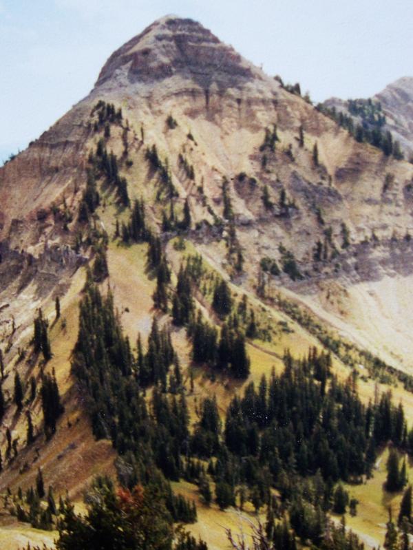
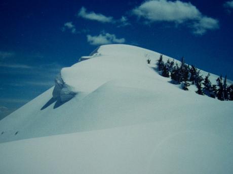
Mount Baird el 10025'. photo by Rick Baugher.
| SnaRR, the Idaho side
Orrin Bonney, the Wyoming guide book author, had this to say about 'The Minor Ranges' which includes the Snake River Range: "Every mountaineer rushing across Wyoming to the Tetons or Wind River Range has spared few glances and less energy looking at the distant blue hills from the highways. These smaller ranges do well at disguising their special pleasures". Bonney wrote this in 1960, and of course, the Snake River Range has now been discovered. I wanted to share some of my discoveries and thoughts on the Idaho side of this range.
Mount Baird el 10025' is the highest peak in the Snake River Range, and is also the Bonneville County, Idaho, highpoint. I first became acquainted with Baird on 7/2/81 by way of a long bushwack up from the YMCA camp at Big Elk Creek.. On 6/19/83, a big snow year, I did a ski ascent/descent of the peak. From 8000' on the Little Elk side I ski climbed up the peak's WNW side. While this was summer snow- packed, channeled, suncupped- the depth was close to 10' near the top. Delicately kicked steps down the narrow north ridge for about 100', then did a totally focused ski descent down Baird's NW face. I used Rossignol's stiff railed 3 pin backcountry ski called the Randonnee, or to use the vernacular of the day Randy&Donnas. Skiing ended abruptly at 8000'.
While I'm not aware of any prior ski descent of this mountain, my tendency is to shy away from the term 'first descent' and instead use what friend, author, and guide Tom Turiano calls 'early ski descent'. After all, what is a first ski descent? Does it count if you get a helicopter or snowmachine assist on the ascent part? How much vertical must be skied to qualify? What if you take skis off to downclimb or use a ski belay? Any difference if you do it solo or in a group? What about the equipment factor- AT, free heel, snowboard? Does the season or ambient conditions affect validity? Does it still count if you wait 26 years to report the descent, with the only proof being your word? What if you NEVER told anyone what you did, or suppose NO ONE else cares, does it still count? First ascents/descents- it's pretty slippery business, wouldn't you say?
View south to Mt Baird from Waterfall Horn el 9722' on 9/3/00. The 1983 ascent went up the standard WNW ridgeline on right. The descent went down the N ridge (facing the camera), then followed the treeline margin into the big bowl on right. Even in June the snow depth in this scooped out bowl was probably 50' deep.
|
| 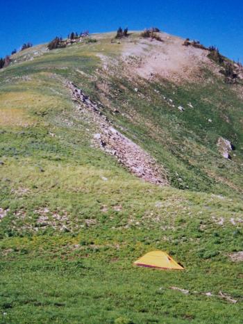
View N to Vacation Peak el 9900' on 7/9/02 from my camp in the col
, photo by Rick Baugher.
|
Follow the ridgeline north from Mt Baird far enough into the core of the Snake River Range and eventually you'll come to Vacation Peak el 9900'. You'll need to take a vacation to get to this peak which overlooks Upper Palisades Lake to the west and the Wyoming line to the east. Try as I might, I couldn't figure out how to do Vacation as a day trip. So, on 7/9/02 I backpacked to the 9300' saddle south of the peak. This way, in addition to a nice Vacation, I was also able to pick off three others: Austin, Little Pal, and Palisades Peak. Mosquitos ate me alive at every stop, so I kept moving. Helpful hint: when the snow is gone these ridgelines are dry- plan your water needs carefully.
|
| 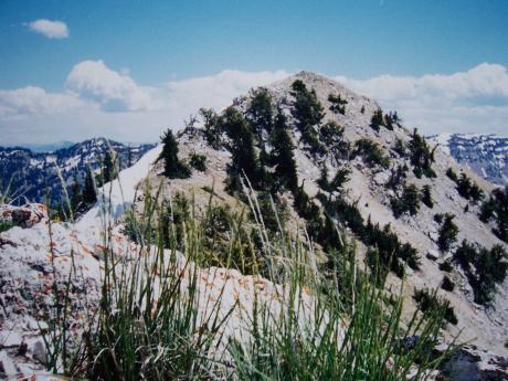
Needle Peak el 9449', photo by Rick Baugher.
|
A rarity in the Snake River Range, Needle Peak el 9449' showed no sign of prior summit occupation on this 6/29/97. A cairn and note were placed. From here there are good views of Palisades Reservoir and Star Valley. At your feet is the massive landslide scar in Blowout Canyon. The maps incorrectly show the 9200' elevation 1/4 mile north of here to be Needle Peak.
|
| 
View S to the Baldy summit on 4/27/98. This is the easiest part of the descent. From here things go downhill fast., photo by Rick Baugher.
|
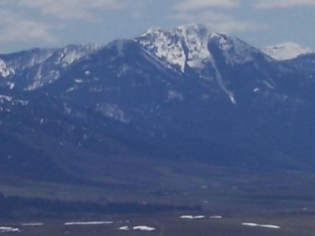
Baldy Mountain el 9835' is probably the most visible peak in the Snake River Range. Besides rising 4000' vertical out of Swan Valley, the sick gash of the Baldy Couloir is the peak's signature feature.
On 3/29/86 I skied Baldy by ascending and descending the peak's NW face alongside, but not in, the avalanche collection trough of the Baldy Couloir. Used 160cm soft alpine skis fitted with 3 pin bindings, and trusty Asolo Extreme leather boots. |
| 
View SE from
Kelly Mountain, about 25 miles away, on 5/8/09. Photo by Rick Baugher.
|
Hazy blue in the distance, even from afar Baldy Mountain is
recognized by the distinctive gash on its west face. Note the smaller
couloir to the left. The ski route went between them. View SE from
Kelly Mountain, about 25 miles away, on 5/8/09.
|
| 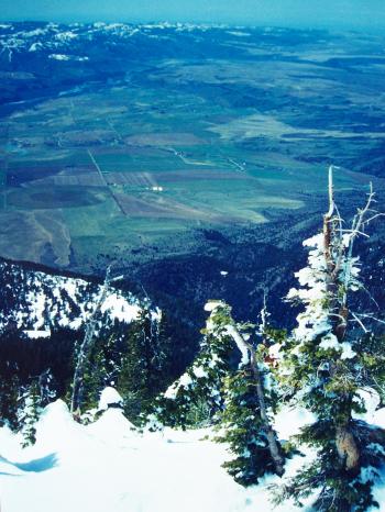
View westward to Swan Valley and the Weeks Ranch, with the Idaho Falls-Rigby area on the horizon. This is at the head of Baldy Couloir, 4/27/98. Photo by Rick Baugher.
|
On 4/27/98 I again skied Baldy, and again the garbage filled chute of the Baldy Couloir scared me away. Perhaps to thumb my nose at the (inevitable) aging process, I cheerfully noted this round trip took only took 6 1/2 hours, much better than my 1986 time of 8 1/4 hours. At the finish had a nice visit with 90 year old Ivan Weeks, a kindly gentleman, who lived his entire life at the base of the mountain. He had never heard of anyone skiing Baldy. This fact was later confirmed by another local, Delbert Winterfield.
Not long ago, my friend Larry Fish, an accomplished distance runner/ biker/ skier, and I were exchanging stories. Larry related how his party had skied Baldy in the mid 80's, but wasn't sure of the exact date. Now, can you understand why I shy away from the term 'first ski descent'? Let's just say Larry and I were early.
Article by
Rick Baugher
5/7/09 |
|